Aquifer Properties
Aquifer Properties
In the previous section, you’ve learned about the different types of aquifers, and the basic characteristics that define an aquifer – namely the ability to store and transmit water. But what, exactly, about a rock or sediment beneath the ground determines whether the rock can hold water, or whether water can percolate through it? In the following section, we will explore this question in more detail, to define the important individual properties of the rock.
Storage
Porosity (usually denoted by the symbol η, which is Greek letter 'eta') is the primary aquifer property that controls water storage, and is defined as the volume of void space (i.e., that can hold water in the zone of saturation) as a proportion of the total volume (Figure 10).


Porosity is expressed as either a fraction, or a percentage:
, or if reported as a percentage,
For aquifers composed of sedimentary rocks or sediments, porosity is usually in the range of ~10-35%. For unfractured crystalline rock, porosity is quite a bit lower - on order of a few percent - because there is little porosity between individual grains other than the vary narrow interfaces along their boundaries (Figure 10).
Several factors can affect porosity. In sedimentary rock and sediments, controls on porosity include sorting, cementation, overburden stress (related to burial depth), and grain shape. Poorly sorted sedimentary deposits, in which there is a wide distribution of grain sizes, typically have lower porosity than well-sorted ones (Figure 11). This is because the finer particles are able to fill in spaces between the larger grains. Cementation caused by precipitation of minerals (typically calcium carbonate or silica) at grain boundaries also reduces porosity (Figure 11). Angular grains generally allow more efficient packing of particles than rounded or spherical ones, also leading to slightly lower porosity. Finally, the more deeply sediments or sedimentary rock are buried, the larger the weight of the overburden; the higher stress leads to compaction, tighter packing of the grains, and lower overall porosity.
Secondary processes that act on the rock or sediment after its formation, primarily weathering by physical or chemical mechanisms, can also affect porosity. Physical weathering by wind or water movement can remove fine clay-sized particles from the sediment (a process termed winnowing), leading to increased porosity near the Earth’s surface. Chemical weathering of certain rock types can lead to clay and oxide formation; depending on the environment and initial composition of the aquifer grains, the clays and oxides may subsequently be removed (porosity increase), or they may grow at the boundaries of other particles and reduce the porosity.
In fractured rock (whether fractured crystalline or cemented sedimentary rock), porosity is typically ~2-5%. The pore space is almost entirely composed of the fractures or cracks themselves, which are typically a millimeter or less in aperture (Figure 12). Two primary factors control porosity – and the connectedness of porosity – in fractured rock. First, increased stress, related to the depth of burial and the weight of the overburden, exerts a clamping force that causes the closure of cracks or fractures (decreases fracture aperture). In some types of rock – most notably limestones – chemical weathering occurs via dissolution as water flows along and through fractures. This leads to increased fracture aperture. Significant enlargement of fractures can lead to the development of karst, typified by large open fractures, caves, and caverns, as well as sinkholes and hummocky topography that ensue as the underlying rock is gradually dissolved (Figure 13).
Interestingly, grain size does not affect porosity. For example, consider a box filled with spherical particles packed as tightly as possible. The proportion of empty space (porosity) would be the same whether the particles are marble-sized, pea-sized, or golf ball-sized; the porosity is controlled entirely by the geometry of the particles – not their dimensions. As we’ll see in the next section, however, grain size does strongly affect the ability of aquifers to transmit water because it directly controls the size of the pore spaces where the water percolates. For example, unconsolidated clays (grain sizes of a few to tens of microns) commonly have porosities of over 50-60%, but they transmit water only one-thousandth to one millionth as well as sands with porosities of 20-30% (grain sizes of a few hundred microns).
Specific Yield (denoted as Sy) is another important quantity for water storage in unconfined aquifers. Sy is defined as the proportion of water occupying void spaces that drains under gravity. Because some water is bound, or adsorbed, to the aquifer particles or fractures, the specific yield is always lower than the porosity (take a look at Figure 8 [2], inset at top left). The attraction between water molecules and the aquifer is due – you guessed it! – to the polar nature of water and surface tension. In sands and fractured rock, Sy is typically a large fraction (>90%) of the porosity, whereas in fine-grained sedimentary deposits Sy may be as low as a few percent because the surface area interacting with water molecules is higher, and pores are smaller, allowing the aquifer to retain more water. In unconfined aquifers, Sy controls the amount of water that can be extracted by pumping.
In confined aquifers, the compressibility of the aquifer is the dominant control on water storage and release. As described above (see Figure 8, right panel), when water is extracted from confined aquifers by pumping or flow to natural springs, the aquifer remains saturated, but the water pressure decreases. Upon depressurization, the aquifer itself can compress slightly. If water is recharged or injected, the opposite occurs: pressure increases and the aquifer expands very slightly. Essentially, by increasing water pressure, more water mass is being “crammed” into the pore space in the aquifer, and vice versa. Although exaggerated, one way to visualize this is to think of pores in the rock or aquifer as a juice box. By changing the pressure inside the box, it will expand or contract. In the same way that a soft juice box will deform more than a stiff one for a given change in pressure, a more compressible aquifer will yield more water than a stiffer aquifer, for the same depressurization. The storage of water in confined aquifers is termed the specific storage, and reported in units of Volume of water/Volume of aquifer per change in water level (so the units are 1/length; e.g., 1/m or 1/ft).


Transmission
Transmission
The ability of an aquifer to transmit water – or of an aquitard to slow the flow of water – is the second essential ingredient controlling groundwater movement. It is also the most variable in natural materials; distances in astronomy are the only other quantity in nature that varies over a similar range! For example, the difference in groundwater flow rate for shale vs. gravel is a factor of 1,000,000,000,000 (yup…one trillion). That’s the difference between the size of an iPhone and the distance from the Earth to the Sun.
Groundwater transport properties are described by two related quantities. Hydraulic Conductivity, denoted by K, is a measure of the ability of a particular fluid (usually water) to flow through the rock or sediment. Permeability, denoted by a lower-case k, is often also termed “intrinsic permeability” and describes the ability of the geologic formation alone to transmit fluid. Although related, the key difference is that hydraulic conductivity combines properties of the geologic formation and the fluid, whereas permeability describes only the rock properties. As described in Sidebar 1, the basic concept of hydraulic conductivity emerged from a series of ingenious experiments conducted in the mid-1880s by Henri Darcy, a French Engineer. These experiments led to Darcy’s Law, which forms the foundation for much of modern hydrogeology and petroleum engineering.
To illustrate the difference between K and k, consider the sandstone in Figure 14 below. The sandstone itself has a permeability, which is controlled by the size of the grains and pore spaces through which water can percolate, and the connectedness and geometry of the pores (more on that in a moment!). That permeability is a characteristic of the sandstone, regardless of whatever fluid might be moving through it, the temperature, or anything else. But the flow rate of water through this sandstone will be different than for oil, or for air, or any other fluid. So the same sandstone also has a hydraulic conductivity specific to a given fluid of interest.

Viscosity and Density
Viscosity and Density
More specifically, it is the viscosity and density of the fluid that matter. More viscous fluids will flow more slowly through the same rock than less viscous ones. This is important for comparing different fluids (say, oil vs. water – whether you are thinking about an oil reservoir or contamination of groundwater by a gasoline spill). It is also important in considering the effects of temperature, because water viscosity decreases with increasing temperature: it’s less than half as viscous at 90° than at 32° F. So even for the same aquifer, the hydraulic conductivity goes up if it is warmer! This makes some sense – if the water is less viscous (i.e. “thinner”), it will flow more easily through the aquifer.
So…that’s how we define permeability and hydraulic conductivity. But what controls their magnitude? The main factors are grain size and shape, sorting, porosity (degree of compaction or fracture aperture), particle orientation or alignment that affects the tortuosity of the flow path, and cementation. Tortuosity is a measure of how far fluid must go to “circumnavigate” its way around particles: higher tortuosity indicates that water must go farther to get to its destination (a more tortuous path). For all of these mechanisms, the key underlying control on groundwater movement is the viscous resistance resulting from the interaction of the fluid with solid surfaces in the aquifer (grain edges or fracture walls).
Importance of Fractures
Importance of Fractures
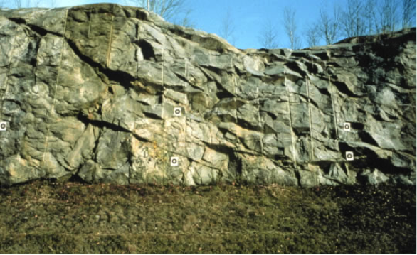
Fractured aquifers are one important and widely used class of aquifer because they are commonly both highly permeable and rapidly recharged. For example, groundwater recharge to the limestone aquifer beneath Nittany Valley in the Spring Creek watershed is around 30-45% of the annual precipitation (in comparison to typical recharge of <10% of precipitation). Fractured aquifers are permeable despite their overall low porosity (usually <5%) because natural fractures usually form in consistent orientations and are well connected in networks over hundreds of meters to tens of kilometers or more (Figures 15-16). The preferred orientation of major fractures leads to anisotropy in permeability, in which the aquifer may be more permeable parallel to the dominant fracture directions than in other orientations.
The rapid flow rates and direct pathways for recharge from the land surface also lead to concerns specific to fractured aquifers. In the absence of confining layers or thick soils, rapid recharge along fractures that extend to or nearly to the land surface increase vulnerability of contamination by surface activity, including fertilization of fields, pesticide application, or spills. Direct connections between surface water bodies and groundwater through major fracture systems also increase the potential for water-borne pathogens to enter the groundwater system, especially during periods of high flow or if confining layers along stream beds are breached. Compounding this risk, if contamination does occur, flow along fracture networks can be very rapid and the direction and rates of contaminant transport difficult to predict - unless the fracture network in the subsurface is extraordinarily well known, which is rarely the case. Because of their potential for contamination, fractured aquifers are a subject of highly active research, including dedicated large-scale field programs (e.g., check out the U.S. Geological Survey’s Mirror Lake project [4]).