No doubt you're familiar with one or more popular online mapping services. How well do they do at geocoding the location of a postal address? You can try it out for yourself at several Web-based mapping services, including MapQuest.com (http://www.mapquest.com) , MSN Maps and Directions (http://mapblast.com), and Tele Atlas's Geocode.com (http://www.geocode.com/). Tele Atlas, for example, is a leading manufacturer of digital street data for vehicle navigation systems. To accommodate the routing tasks that navigation systems are called upon to serve, the streets are encoded as vector features whose attributes include address ranges. (In order to submit an address for geocoding at geocode.com you have to set up a trial account).
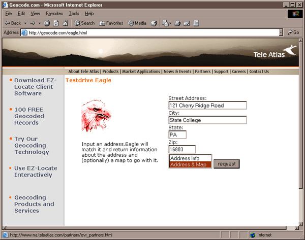
Submitting an address to Tele Atlas' Geocode.com service for geocoding. © 2002 Tele Atlas North America, Inc. All rights reserved.
Shown above is the form by which you can geocode an address to a location in a Tele Atlas street database. I've entered my home address. The result is shown below.
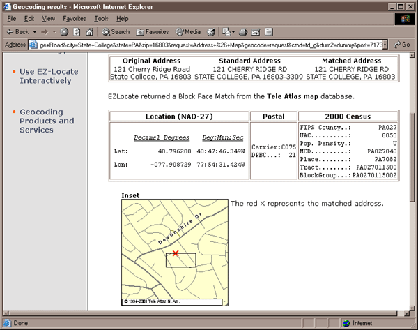
Tele Atlas' Geocode.com service estimates the location of the address relative to the address range attributes encoded in its database. © 2002 Tele Atlas North America, Inc. All rights reserved..
The geocoded location shown above is on the correct side of the street, but about halfway up the street from its actual location. This suggests an inaccuracy in the address range attribute associated with the vector line feature that represents my street; perhaps the low addresses start on the wrong end of the street.
Let's compare the geocoding capabilities of MapQuest.com.
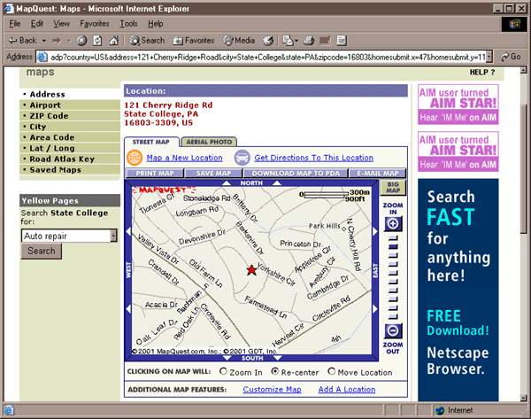
Same address geocoded by MapQuest.com. © 2002 MapQuest.com, Inc. All rights reserved.
In the map shown above, produced by MapQuest.com, the estimated location of my address is closer to its actual location, except that it seems to appear on the opposite side of the street. What do you suppose is wrong with the address range attribute in this case?
Below is a similar MapQuest product I created back in 1998, when I first started developing this course. Notice how much the shapes of the streets have been improved since then. The 1998 product seems to have been generated from the 1990 version of the TIGER/Line files, which may have been all that was available for this relatively remote part of the country. Now MapQuest licenses street data from a business partner called NAVTEQ (http://www.navteq.com/).
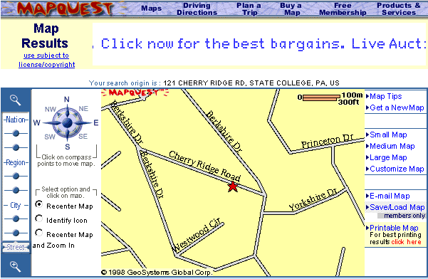
Same address geocoded by MapQuest.com in 1998. © 1998 MapQuest.com, Inc. (formerly GeoSystems Global Corp.) All rights reserved.
The point of this section is to show that geocoding with address ranges involves a process of estimation. The Census Bureau's TIGER/Line files, like the commercial street databases produced by Tele Atlas, Navigation Technologies, and other private firms, represent streets as vector line segments. The vector segments are associated with address range attributes, one for the north side of the street, one for the south side. The geocoding process takes a street address as input, finds the line segment that represents the specified street, checks the address ranges to determine the correct side of the street, then estimates a location at the appropriate point between the minimum and maximum address for that segment. For example, if the minimum address is 401, and the maximum is 421, a geocoding algorithm would locate address 411 at the midpoint of the street segment.
| Try This! | Try one of these geocoding services for your address. Then compare the experience, and the result, with Google Maps (http://maps.google.com), launched in 2005. Apply what we've discussed in this chapter to try to explain inaccuracies in your results, if any. Registered students can log in and post comments directly to this page. |
| Practice Quiz |
Registered Penn State students should return now to the Chapter 4 folder in ANGEL (via the Resources menu to the left) to take a self-assessment quiz about Geocoding. You may take practice quizzes as many times as you wish. They are not scored and do not affect your grade in any way. |
 |
Students who register for this Penn State course gain access to assignments and instructor feedback, and earn academic credit. Information about Penn State's Online Geospatial Education programs is available at http://gis.e-education.psu.edu. |