Lesson 1
What is Geospatial Intelligence?
Introduction
Welcome to Lesson 1 of Geospatial Intelligence & the Geospatial Revolution!
We've identified five principles of Geospatial Intelligence that will be addressed throughout this course. These principles are:
- Principle #1:Geospatial Intelligence concerns insights about human activity on the Earth.
- Principle #2: The analyst's craft completes the picture provided by geospatial intelligence data.
- Principle #3: Geospatial Intelligence collection and source strategies are focused on answering questions about place and time.
- Principle #4: The Geospatial Intelligence analysis tradecraft is the art of geospatial reasoning informed by Geographic Information Science aided by Geographic Information Technology.
- Principle #5: The Geospatial Intelligence analyst makes judgments consistent with the standards of the intelligence profession.
This lesson introduces Geospatial Intelligence (GEOINT) and the broad types of problems it can help you solve. I will use the term GEOINT as an abbreviation of geospatial intelligence throughout most of this course. GEOINT is defined by the intersection of the intelligence tradecraft, Geographic Science (GIScience), and Geographic Information Technology (GIT). As a discipline, GEOINT provides decision makers with insights about the ways in which people organize and arrange their activities on Earth's surface. These insights can prevent surprises, leverage emerging opportunities, counteract threats, or provide time to adapt to a changing situation. GEOINT is not just about defense applications. GEOINT provides decision makers with actionable knowledge in business, humanitarian efforts, and law enforcement. We will explore the ethical aspects of GEOINT that arise since Geographic Information Technologies are inherently surveillance technologies.
Learning Objectives
Throughout this lesson, we will demonstrate the concepts of GEOINT. By the end of this lesson, you will be able to:
- Define GEOINT
- Name several applications of GEOINT
- List the unique qualities of GEOINT
L1.02: The Geospatial Revolution
Before we begin to explore GEOINT, let's examine the Geospatial Revolution by watching Episode One of the Geospatial Revolution (14 minutes) video series.
If you are unable to access the video above, try going directly to the Geospatial Revolution site [1]
As the video illustrates, in a few short years we have gone from mountains of hardcopy maps to amazing automated systems that provide insights about human use of geography. This class is not about the Geospatial Revolution per se, but how the revolution changed the way we think about, develop, and use GEOINT. Seamless layers of satellites, surveillance, and location-based technologies create a knowledge base vital to the interconnected global community. The Geospatial Revolution video describes the history, applications, related privacy issues and impact of location-based technologies that have transformed geospatial intelligence.
L1.03: Video Lecture 1.1
Need the video embed code from Coursera.
Let's explore what GEOINT is in the following video lecture (9 minutes).
L1.04: Assignment
Make Two Maps
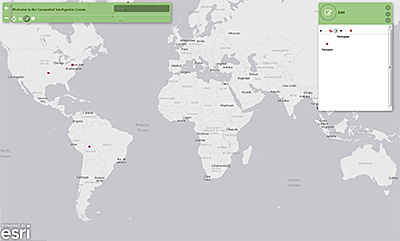
Let's create two ad hoc maps by dropping pin markers to designate the following:
Map 1 - The Location of Your Home
For the first part of the assignment, you are asked to drop a pin marker on the location of your home using ArcGIS Online. After you add your pin, you will see a popup box with three fields to populate with your age, gender, and why you are taking this course (Why GEOINT). Click on the map below to launch ArcGIS Online.The instructions are contained on the right side of the map. You can change to a background image in the "Basemap Gallery" to help accurately locate your house before you drop the pin.
 [3]
[3]
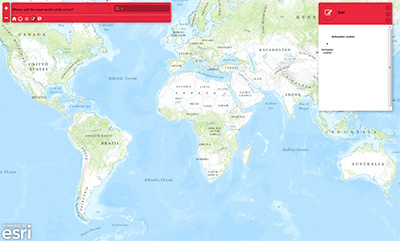
Map 2 - The Location of the Next International Disaster
For the next part of the assignment, I am going to ask you to anticipate something based on your experience, knowledge, or just a gut feeling. Think carefully about this. Below the map, I have provided some guidelines you should consider before placing your pin on the map. When you are ready, click on the map below to launch ArcGIS Online and drop a pin marker on the location of where you predict the next international disaster will occur. A pop-up will appear for you to select the country that you live in. I will refer back to this data in Lesson 4.
 [4]
[4]
Your anticipated disaster must fulfill one or more of the following criteria:
- Ten (10) or more people reported killed.
- One hundred (100) or more people reported affected.
- Declaration of a state of emergency.
- Call for international assistance.
The cause of the anticipated disaster should fall into one of the following subgroups:
| Disaster Subgroup | Definition | Disaster Main Type |
|---|---|---|
| Geophysical [5] | Events originating from solid earth | Earthquake, Volcano, Mass Movement (dry) |
| Meteorological [6] | Events caused by short-lived/small to meso scale atmospheric processes (in the spectrum from minutes to days) | Storm |
| Hydrological [7] | Events caused by deviations in the normal water cycle and/or overflow of bodies of water caused by wind set-up | Flood, Mass Movement (wet) |
| Climatological [8] | Events caused by long-lived/meso to macro scale processes (in the spectrum from intro-seasonal to multo-decadal climate variability) | Extreme Temperature, Drought, Wildfire |
| Biological [9] | Disaster caused by the exposure of living organisms to germs and toxic substances | Epidemic, Insect infestation, Animal Stampede |
You might wish to view the Emergency Events Database (EM-DAT). EM-DAT was created with the initial support of the World Health Organization and the Belgian Government. The main objective of the database is to serve the purposes of humanitarian action at national and international levels. Use the following link to access the Emergency Events Database [10] directly.
Technical Notes
Let's briefly discuss a few technical notes to ensure your success using ArcGIS Online in our course:
- We will be making full use of web mapping services. The maps in these services are laden with information, and therefore, a robust web connection is important throughout the course.
- To take advantage of these web-based technologies, you need to be using a fairly new version of a standard web browser, such as Firefox, Chrome, Safari, or Internet Explorer. In other words, a 5 year old browser will not work well with the Java and other scripts running the maps behind the scenes, and therefore, an old web browser may not display your maps correctly.
- To maximize the speed at which your web browser runs, consider disabling or removing some add-on and plug-in extensions to your web browser, including “Ask” toolbars and other items that reduce the amount of canvas space that you might wish for your maps and that tend to take up memory and slow down your web browser.
- Because our course is web-based and uses dynamic maps, as with anything on the web, be patient, practice the problem-solving techniques modeled in this course, and be flexible. If a certain map or website won't display at a particular time, try a different browser or try it at a different time, or try truncating the URL and approaching the desired URL from the organizational root of the URL. If it still won’t appear, we would rather have you move on and think about the larger issue that we are discussing, not, for example, the technical details on whether you can add a photo image as a pop-up to your map. You can always come back to a particular resource later and try again. Keep learning and ... have fun!
Here re a few resources that might be helpful:
- What Is GIS [11]
- ArcGIS Online [12]
- Get Started with ArcGIS Online [13]
Credits
The ArcGIS Online capabilities used here were developed by the absolutely amazing Joseph Kerski [14], Geographer and Esri Education Manager.
L1.05: Geospatial Intelligence
What is Geospatial Intelligence?
The United States influenced the geospatial intelligence [15] discipline with the creation of intelligence organizations. The NIMA Act of 1996 [16] establishing the National Imagery and Mapping Agency [17], and the subsequent amended language in the 2003 Defense Authorization Act [18] codified the mission of the National Geospatial-Intelligence Agency (NGA) [19]. This resulted in the integration of multiple sources of information, intelligence and trade crafts into NIMA, which subsequently became NGA. Then Director James Clapper [20] (2001- 2006) designated this discipline as Geospatial Intelligence, or GEOINT [21]. It teaches something that Director Clapper used a hyphen when the National Geospatial-Intelligence Agency was formed. What might have been the “NGIA” is referred to today as the NGA and thereby giving it seeming parity with its three-letter counterparts; the FBI [22], CIA [23], DIA [24], NSA [25], and NRO [26]. This naming seems to be a public policy decision by agency officials, so it's not unreasonable to suggest that politics played a role not only in the name, but that it also influenced the vocation and discipline that emerged as Geospatial Intelligence, or as abbreviated, GEOINT. The following quote from a former three-decade agency employee illustrates the nature of the change:
I was at work the day he [Director Clapper] declared we are NGA, not NIMA. We all looked at each other and said "now what the hell is he doing?" Clapper was, without a doubt, the most prolific reorganizer I ever worked under, and we figured it was just an excuse to reorganize yet again. Everyone ran all around, including my boss, waving their arms "what does geospatial mean? ... As we found out later, it was really the beginning of the true integration of maps, charts, geodesy, imagery and intelligence that has evolved into what NGA is today.
Significantly, the term Geospatial Intelligence, and GEOINT, has become an internationally recognized concept as exemplified by its use in events such as the United States Geospatial Intelligence Foundation's (USGIF) [27] GEOINT Symposium, which has roots back to 2003. Why do I mention this history?
What is Geospatial Intelligence, or GEOINT? Let's begin examining this question with a video (NGA Power of GEOINT, 6:20 [28]) produced by the US National Geospatial-Intelligence Agency (NGA). [29]
So, what is unique about this discipline that distinguishes it from other branches of geography and geographic analysis? Let's begin by defining the individual terms Geospatial and Intelligence.
- Geospatial pertains to or relates to the relative position of things on the Earth's surface.
- Intelligence is information gathered to guide decisions. It includes information that may be both open and closed, and may be obtained from many different sources.
Let me expand upon the word geospatial. While the words geospatial, geographic, and spatial are often used interchangeably to mean similar things, the reasoning behind the linguistic blend forming geospatial is that spatial alone is too generic and geographic is too related to the particular discipline of geographic intelligence [30]—one of the oldest forms of military intelligence.
Let's also look at the word intelligence. Intelligence provides a “decision advantage” intended to prevent surprise, capitalize on emerging opportunities, neutralize threats, or provide time to adapt to a changing situation. To the average person, intelligence is often associated with secrets and spying. However, according to noted author, academic, and experienced national security expert, Mark Lowenthal [31], viewing intelligence as primarily secrets misses the important point that intelligence is ultimately information that meets the needs of a decision maker. Intelligence is information that has been collected, processed, narrowed, and offered to meet those needs, which could apply to any domain. Lowenthal also asserts a central notion that intelligence is not about truth, but is more accurately thought of as a “proximate reality.” Intelligence analysts do their best to arrive at an accurate approximation, but they are rarely certain that their best analytic insights are true when completing an analysis. So, semantically, GEOINT provides insights to a decision maker about how humans relate to the Earth.
L1.06: The Emerging Definition
The Official Definition of GEOINT
The official United States Government definition of Geospatial Intelligence is stated in U.S. Code Title 10, §467 [32] as:
The term 'geospatial intelligence' means the exploitation and analysis of imagery and geospatial information to describe, assess, and visually depict physical features and geographically referenced activities on the earth. Geospatial intelligence consists of imagery, imagery intelligence, and geospatial information.”
It is not unreasonable to say that this definition, written in 2003, was crafted to inform how NGA operated with the other US intelligence agencies, but was not intended as the functional definition of the discipline. I might note that there is no hyphen between the words geospatial and intelligence.
GEOINT is the commonly used acronym formed from the initial components of the words "Geospatial" and "Intelligence." It has been said that the 2003 renaming of NIMA to NGA recognized the emergence of geospatial information as an intelligence source [33] in its own right. In the US, the term GEOINT is used to connote a source of intelligence like HUMINT [34] or SIGINT [35]. The national differences notwithstanding, GEOINT is different from the other sources (e.g., SIGINT) and is inherently multi-source. This is to say, it integrates and enriches information collected by the other INTs into a space-time context.
Emerging Definition of GEOINT
The narrow definition of GEOINT in the U.S. Code does a disservice to the discipline when considering geospatial intelligence is broader than as narrowly defined in the US law. While Geospatial Intelligence is essential in the traditional intelligence areas of deterring war, resolving conflict, and promoting peace, GEOINT is also important to other areas such as supporting the commercial sector and civil authorities. There is an emerging definition of Geospatial Intelligence that is vastly different from the U.S.'s statutory definition. An enhanced definition was offered by Bacastow and Bellafiore in 2009. The emerging definition is:
Geospatial intelligence is actionable knowledge, a process, and a profession. It is the ability to describe, understand, and interpret so as to anticipate the human impact of an event or action within a place-time environment. It is also the ability to identify, collect, store, and manipulate data to create geospatial knowledge through critical thinking, geospatial reasoning, and analytical techniques. Finally, it is the ability to present knowledge in a way that is appropriate to the decision-making environment.
In the above definition, I want to highlight that GEOINT's process includes Geographic Information Science (GIScience) and Geographic Information Technologies (GIT) when creating geospatial knowledge. Recall that GIScience and GIT are also referred to collectively as GIS&T [36]. I want to be absolutely clear that GIScience and GIT includes the US Title 10 elements of imagery and imagery analysis. In fact, GIScience and GIT (collectively GIS&T) are promoting an integration of the science and technologies associated with remote sensing, geodesy, surveying, photogrammetry, image processing, and many more disciplines including, but not limited to, cartography and the cognitive sciences.
Central to this emerging definition is the notion that the focus of GEOINT is understanding how people organize and arrange their activities on Earth's surface. For all the emphasis in GEOINT on data and technologies, people remain GEOINT's most precious analytic resource. The analyst describes, understands, and interprets so as to anticipate the human impact of an event or action. The analyst's work involves the analysis of place [37] and time using geographic information sciences (GIScience [38]), geographic technologies (e.g. satellites [39], UAS [40], UAV [41], GPS [42], GIS [43], and cyber [44]) and a unique tradecraft [45].
L1.07: Problems GEOINT Can Help to Solve
Please view Chapter One of Episode Three in the WPSU Geospatial Revolution [1] series. This video examines how geospatial and location-based technologies influence warfare, diplomacy, police protection and privacy issues.
If you are unable to access the video above, try going directly to the Geospatial Revolution site [1]. If YouTube is blocked in your country, you may be able to see this video on Vimeo [46].
Optionally, please feel free to view the following videos that illustrate how GEOINT's principles provide apply to deterring war, resolving conflict, promoting peace, defining business competition, or supporting civil authorities.
Site Location Analysis for a New Metropolitan Airfield
Rob Williams, Penn State, developed the following video as part of his Capstone for the GEOINT Certificate. It involves a business problem that has had his personal and professional interest over the years.
The CyberTracker Story
See how many of GEOINT's technology and principles apply in other realms. Louis Liebenberg, a scientist turned tracker, is revolutionizing conservation and wildlife management using GEOINT-like technologies and techniques. His efforts are documented in The CyberTracker Story [47] video below (8:18).
Need embed code for this video too --- do we even have permission to use this? or need it?
 [47]
[47]Note
Do you have a question related to the above examples and not directly associated with this lesson? Do you just want to express your thoughts about some aspect of GEOINT? A team of GEOINT practitioners will address your posts made to GeoINTsights Forum! [48]. This link currently resolves to Coursera.
L1.08: What Makes GEOINT Different?
How is GEOINT Different?
At this point you may be asking, "How is GEOINT different as a discipline and unique from other geospatial analytic activities?" GEOINT is a sub-discipline of geography and is unique from other forms of geospatial analysis because of its tradecraft. Specifically, GEOINT delivers insights gained from place and time for a decision advantage by integrating Geographic Information Science (GIScience), Geographic Information Technology [38], [38] and its unique tradecraft. Let's examine the highlighted terms:
Place
Place is fundamental to geography and perhaps the most important concept in GEOINT. At first glance, location and place might seem to be similar terms; however, places have physical and human attributes that make them what they are. Physical attributes may include a description of such things as the mountains, rivers, beaches, and topography of a place. Human characteristics may include the human-designed cultural features of a place, from land use and architecture, to forms of livelihood and religion, to food and folkways, to transportation and communication networks. Place emphasizes the understanding of both of these factors and their integration. To illustrate this you might explore the TED Talk by Daniele Quercia that explains how "happy maps [49]" that take into account not only the route you want to take, but how you want to feel along the way. The following is from an article published by Dr. George Van Otten in the April-June 2014 Issue of the Military Intelligence Professional Bulletin [50].
Places have unique attributes and characteristics that give them identifiable personalities. Therefore, they are constantly evolving in response to a multiplicity of environmental and human influences. Because places are in a constant state of change, sometimes for the better and sometimes for the worse, they greatly influence the lives of those who live in or near them. Places are the settings in which people experience life, develop relationships, and form their own unique identities. Human personalities do not form in a vacuum. Instead, they are a product of biology, family structure, and the nature of the places in which individuals live.
In addition to the concrete or absolute space in which places are situated, there are also places that are products of human hearts and minds. In fact, it is common to hear elderly people describe the places where they lived, loved, and worked many years ago, even though these places (as they once were) are no longer part of the modern landscape. Moreover, people are often emotionally tied to specific places. Consider the emotional attachment of most Americans to the site of the World Trade Center in New York City, or the powerful emotional and cultural symbolism associated with the Vietnam War Memorial in Washington, D.C.
Places do not usually elicit the same reactions from everyone. While some people think of bucolic settings as ideal, others see them as primitive and uncivilized. Conversely, many see great beauty in the skylines of great cities, while others consider them to be blights on the landscape.
In some places, people are resilient and open to change, while in others, people are tradition-bound and resist even the mildest cultural, social, economic or political changes. Moreover, such resistance sometimes results in conflict, violence, and even war. Understanding the degree to which a people are committed to preserving the status quo relative to the places in which they live should be a fundamental part of the IPB process [51], because conflict (even low intensity conflict), nation building efforts, and peace-keeping missions all involve changing the nature of the places in which they occur.
Although places are unique expressions of human occupancy in time and space, most are also interdependent. This is because each place tends to fill a specialized role relative to the greater region in which it exists. Some places focus on primary sector activities including agriculture, mining, logging, and commercial fishing, while others serve as centers of commerce, processing, government, and/or manufacturing. All of these places must regularly interact with each other to survive. To fully understand the character of a given place, geographers must be able to identify these interdependencies, while at the same time keeping in mind the distinctive qualities that give specific places their unique personalities. In order to fully comprehend the long-range implications of operational plans in a contested area, professional military analysts must understand the importance of interdependencies between communities, nations, and regions. History is replete with examples of military actions that have resulted in far-reaching unintended consequences. For example, while closing a major regional transportation artery might bring short-term positive results to a specific place, it may also create great regional chaos for allies who depend on that network for vital shipments of food, fiber, and energy.
Places are building blocks of analysis in GEOINT, keys to making sense of the landscape, stages for events, and testimonial to the fact that humans require space to live, work, play, and flourish. People create distinctive places according to their knowledge, technology, and needs. Places are involved in important decisions—personal, corporate, and governmental. Places exemplify the principle events of history. Understanding a place's history, variety, and complexity, and how that place may have shaped a human's life and experiences, are keys to cultural understanding.
Ultimately, in GEOINT, we are concerned with understanding why places, and people in those places, are located where they are and how they interact. To answer this question, we must be comfortable with the underlying concepts and theories of the spatial distribution of a particular phenomenon. The spatial distributions can be a human phenomena, such as population and religion. The spatial distribution can be some sort of the relationship between society and nature, such as potential deaths to natural disasters, as a reflection of topography and socioeconomic processes allocating particular kinds of people to particular places and construction types.
In general terms, geospatial analysis and GEOINT can be considered to be the formal quantitative study of spatial linkages that manifest themselves in space. Spatial linkages are explained using theories and observations such as the First Law of Geography [52]. [52] According to Waldo Tobler [53], "Everything is related to everything else, but near things are more related than distant things." This law is related to the law of demand, in that interactions between places are inversely proportional to the cost of travel, which is much like how the probability of purchasing a good is inversely proportional to the cost. Within the GEOINT community, Tobler’s First Law of Geography is regarded as a fundamental and a key to analytic insights.
Time
Geography and, hence GEOINT, approaches the explanation of spatial phenomena through the change of geographical features. For example, before May of 2011, an estimated 300 Syrian refugees had crossed the Turkish border to avoid war. By 2014 the number of Syrian refugees in Turkey grew to 400,000. Space and time are inexorably linked. Over forty years ago, a Swedish geographer, Torsten Hägerstrand [54], illustrated how human spatial activity is often governed by time limitations. He identified three categories of limitations: capability constraints, coupling constraints, and authority constraints.
- Capability constraints refer to the limitations on human movement due to physical or biological factors. For example, a person cannot be in two places at one time.
- A coupling constraint refers to the need to be in one particular place for a given length of time, often in interaction with other people. For example, your space-time path must temporarily link up with certain people to accomplish a particular task.
- The authority constraint is a controlled area that sets limit on its access to particular individuals. For example, a person's space-time path is normally not permitted to enter a sensitive military base.
Hägerstrand's concept of space-time is powerful. Hägerstrand's space-time model [55] provides a framework for understanding human activity and provides a theoretical foundation for intelligence concepts such as Activity-Based Intelligence (ABI) [56].
Geographic Information Science (GIScience)
Please recall that geographic information science and geographic information technology are referred to collectively as GIS&T. I will address each of the concepts separately here.
Geographic information science (GIScience or GISci) includes scientific research areas of geographic information systems (GIS), cartography, remote sensing, photogrammetry, and surveying. GIScience addresses fundamental issues in the use of digital technology to handle geographic information about places, activities, and phenomena on and near the surface of the Earth that are stored in maps or images. GIScience includes fundamental questions of data structures, analysis, accuracy, meaning, cognition, and visualization to name a few. As such, GIScience overlaps with many traditional disciplines such as earth science, mathematics, computer science, physics, cognitive science, and ethics. While GIScience is not central to any of these disciplines, researchers from many different backgrounds work together on particular sets of interrelated problems.
I've gotten the important question: why is imagery and imagery analysis not included in this list as a separate item since remote sensing, remote sensing technologies, and image analysis are important to capturing, creating, storing, managing, querying, displaying, and analyzing picabytes of accurate, reliable, timely and relevant GEOINT data? I suggest that remote sensing and imagery analysis are a key and growing part of GIScience and Geographic Information Technologies. What are your thoughts?
Geographic Information Technology (GIT)
The term "geographic information systems" (GIS) has been used to describe the hardware, software, geographic data, and people that enable geospatial information processes for making decisions. More recently, GIS, together with global positioning systems (GPS), remote sensing techniques, and other spatially related tools for decision making, comprise a larger array of tools that can be grouped together under the more complete term of "geographic information technologies" (GIT).
Tradecraft
Tradecraft is what makes GEOINT unique and is addressed in greater detail in Lesson 4. We define the GEOINT tradecraft as encompassing the unique organizational sources and methods [57] for obtaining GEOINT data and making sense of it to support the decision maker. GEOINT's methods comprise the tools to organize geospatial data and the reasoning techniques for rendering judgments, insights, and forecasts about human activities and intentions. The skills of detecting geospatial deception [58] and, where required, maintaining secrecy of geospatial sources and methods makes GEOINT unique. I fully appreciate that the word secrecy is provocative. Secrecy, which is often contrasted with transparency as an ideal, has negative connotations and is often associated with spying [59] and espionage [60]. However, in a real way, total transparency is unnatural and seldom occurs. Humans conceal aspects of their lives from others due to fear of inappropriate use of the information, embarrassment, retribution, denunciation, harassment, or loss of employment.
Espionage link (last link on page) is broken
L1.09: Is GEOINT an Art or Science?
There are competing views on whether GEOINT is an art or a science. This controversy mirrors a long-standing debate in the intelligence community over whether intelligence analysis is based on subjective, intuitive judgment (an art), or systematic analytic methods (a science). One school is that intuition, experience, and subjective judgment dominate. Here, GEOINT is an art. Another school is that structured data [61]and computers are most relevant. Here GEOINT is science-like. While this controversy is somewhat academic, it does have an impact on what automation can be appropriately applied and on the training and education of the worker. To help understand these points of view, I will define the terms using the Merriam-Webster Collegiate Dictionary, tenth edition, as:
- Art - the conscious use of skill and creative imagination in the production of aesthetic objects.
- Science - knowledge or a system of knowledge covering general truths or the operation of general laws, especially as obtained and tested through the scientific method.
GEOINT has the qualities of an art and science where there is no certain dividing line between the two. GEOINT's automated processes are not rich enough in underlying geographical knowledge to accurately reflect reality. This is to say, for something to be automatable, how it works must be described (modeled) and the facts (data) quantified. Since a model is a simplified view of reality, the model represents a limited set of rules which allows analysts to work out an answer if they have certain information. Quantifiability of the information is important because unquantifiable inputs (data) cannot be tested, and thus unquantifiable results can neither be duplicated nor contradicted. The table below categorizes the broad types of GEOINT problem-solving processes.
| Model Certainty: Low |
Model Certainty: High |
|
|---|---|---|
| Data Certainty: High |
Model Building | Puzzle Solving |
| Data Certainty: Low |
Mystery Solving | Data Foraging |
The upper right panel of the matrix identifies analysis type as Puzzle Solving (upper right quadrant) in which there is good knowledge of the data and models surrounding an output. This is, perhaps, the ideal. Analysts understand the problem and can take into account the data. The notion of fixed-in-advance standard procedures typically plays an important role in such geospatial analysis. However, many of the analytic tasks in geospatial intelligence fall outside this quadrant. Consider the Data Foraging (lower right) quadrant, in which there is agreement on models, but a lack of certain data. The notion of "foraging" for the data plays an important role in problem solving.
Model Building (upper left quadrant) is the opposite. In this analytic environment, there is seemingly sufficient data, but disagreement on the model. Analysis is characterized by analysts involved in a struggle for their model to prevail, and decisions emerge from that struggle. This kind of analysis is characterized by bargaining, accommodation, and consensus, as well as controversy. GEOINT as Mystery Solving (lower left quadrant) is the most open to debate. Under these conditions, science and technology tools have significantly less relevance. As a consequence, the analytic process is experience-based. In the end, this is the framing of complex questions, often called wicked problems [62]. They can only be framed, not solved, and thus the logic of argument and analysis is important.
Is GEOINT an art or science? GEOINT's problems fall into any of the four quadrants ---- you, the individual doing the analysis, need to understand the problem and the nature of the problem solving process.
L1.10: GEOINT and Ethics
Is GEOINT Ethics an Oxymoron?
To some, the notion of GEOINT ethics is an oxymoron—especially in light of the secrecy associated with intelligence work. There is a love-hate relationship with intelligence agencies and what they do. We celebrate the intelligence work of Bletchley Park [63] and fictional characters like James Bond but, as James Olson points out, people are more likely to believe intelligence agencies pervert national values rather than protect them (Olson, 2006) and want nothing to do with the profession. Unfortunately, this sentiment misses an important point. GEOINT is here to stay and, moreover, is exploding in the largely unregulated business community. Given GEOINT's hidden massive increase within the commercial sector, the profession needs a code of ethics more than ever. If for no other reason, a code of ethics is important to GEOINT since it recognizes an obligation of the profession to society that transcends self interest.
Consider that we share our location via our phones, Twitter, and photos that are taken with our cameras. While these geospatial traces are generally benign, there is concern especially with respect to government collection and use of this geospatial trace information. Interestingly, commercial collection, use, and distribution (resale) of these personal geospatial traces likely exceeds that of government. The World Privacy Forum, a research and advocacy organization, estimates that there are about 4,000 data brokers. These companies collect and resell data from sources including consumer health websites, lenders, online surveys, warranty registrations, Internet sweepstakes, loyalty card data from retailers, charities’ donor lists, magazine subscription lists, and information from public records (The New York Times Op-Ed: "The Dark Market for Personal Data [64]"). Some countries are exploring measures to protect against location technology abuses.
Jeremy Crampton (2003), a well recognized academic in the realm of ethics and geography, noted that an "increasingly significant component of security discourse comes from a spatial or geographic standpoint" and the "issue of security is often contrasted against issues of privacy or civil rights." This is because technologies such as the Global Positioning System (GPS), satellite remote sensing, and geographic information systems (GIS) are inherently surveillance technologies. The data they produce may be used to invade the privacy of individuals and groups. Data gathered using geospatial technologies are used to make policy and personal decisions. Erroneous, inadequately documented, or inappropriate data can have grave consequences for individuals and society. Geospatial technologies have the potential to exacerbate inequities in society, insofar as large organizations enjoy greater access to technology, data, and technological expertise than smaller organizations and individuals (Ethics Education for Geospatial Professionals - About [65]).
In the following video, Donald R. Shemanski [66] of Penn State's College of Information Sciences and Technology (IST) addresses the growing concern with respect to US law.
Paste embed or iframe code here to replace the video below

Code of Ethics
Ethics involves systematizing, defending, and recommending concepts of right and wrong conduct. In our everyday life we follow the moral virtues: be honest, don't steal, harm, etc. But GEOINT often involves activities in gray areas of moral thought. The intelligence professional has long faced the moral dilemmas of balancing the national interests in security against some other societal virtues. An example is the case study Mapping Muslim Neighborhoods [67]. Today, GEOINT has the added moral dilemma of balancing privacy against the convenience of using such features as "Location Services" on your smart phone.
The Society of Competitive Intelligence Professionals (SCIP) has a code of ethics that is among the simplest. The University of Illinois has a collection of ethical codes from many sources at its Institute of Technology Code of Ethics website [68]. The SCIP Code of Ethics is:
- To continually strive to increase the recognition and respect of the profession.
- To comply with all applicable laws, domestic and international.
- To accurately disclose all relevant information, including one's identity and organization, prior to all interviews.
- To fully respect all requests for confidentiality of information.
- To avoid conflicts of interest in fulfilling one's duties.
- To provide honest and realistic recommendations and conclusions in the execution of one's duties.
- To promote this code of ethics within one's company, with third-party contractors, and within the entire profession.
- To faithfully adhere to and abide by one's company policies, objectives and guidelines.
Many governments have special laws for their spies that grant them immunity from laws that apply to ordinary citizens. Some of those special laws can be found in the public domain, but many are secret.
Guide to Making Ethical Decisions
Michael Davis (Davis, Michael (1999) Ethics and the University, New York: Routledge, p. 166-167) proposes a seven-step guide to help think through some complex ethical case studies. A key feature of Davis' approach is his emphasis on identifying multiple (more than two) options for responding to ethical challenges. Another is the series of tests presented in Step 5.
Seven-step guide to ethical decision-making (Davis 1999)
- State problem.
- For example, "there's something about this decision that makes me uncomfortable" or "do I have a conflict of interest?"
- Check facts.
- Many problems disappear upon closer examination of the situation, while others change radically.
- Identify relevant factors.
- For example, persons involved, laws, professional code, other practical constraints (e.g. under $200).
- Develop list of options.
- Be imaginative, try to avoid "dilemma;" not "yes" or" no" but whom to go to, what to say.
- Test options. Use such tests as the following:
- harm test: Does this option do less harm than alternatives?
- publicity test: Would I want my choice of this option published in the newspaper?
- defensibility test: Could I defend choice of option before a congressional committee or a committee of peers?
- reversibility test: Would I still think choice of this option good if I were adversely affected by it?
- colleague test: What do my colleagues say when I describe my problem and suggest this option is my solution?
- professional test: What might my profession's governing body for ethics committee say about this option?
- organization test: What does the company's ethics officer or legal counsel say about this?
- Make a choice based on steps 1-5.
- Review steps 1-6. What could you do to make it less likely that you would have to make such a decision again?
- Are there any cautions you can take as an individual (and announce your policy on question, job change, etc.)?
- Is there any way to have more support next time?
- Is there any way to change the organization (for example, suggest policy change at next departmental meeting)?
In his book Profession, Code, and Ethics (2002) Davis makes the point that people who claim to be members of a profession have special ethical obligations beyond what the law and ordinary morality require. Those special obligations are stated in the codes of ethics that many professions, firms, and government agencies publish. The intelligence professional is expected to have an understanding of, and experience in thinking about, moral and ethical problems. It may well be that the most significant aspect of the preparation of the intelligence professional is the informed judgment that enables them to make discriminating moral choices.
L1.11: Discussion Assignment - Ethics of the Pin
For this week's discussion I want to focus on ethics and specifically on the "pin" of your home that I asked for. However, before you head over to the dedicated Lesson 1 Discussion Forum [48]to talk about the issue, here are a few prompts for this week's discussion: These are Coursera instructions.
- Display the map showing the locations where the students of this class pinned their homes.
- Explore the data to see if individuals pinned their home locations.
- Argue if it was or was not ethical for me to ask you to "pin" your home location.
You might then consider that The Society of Competitive Intelligence Professionals' (SCIP) Code of Ethics is:
- To continually strive to increase the recognition and respect of the profession.
- To comply with all applicable laws, domestic and international.
- To accurately disclose all relevant information, including one's identity and organization, prior to all interviews.
- To fully respect all requests for confidentiality of information.
- To avoid conflicts of interest in fulfilling one's duties.
- To provide honest and realistic recommendations and conclusions in the execution of one's duties.
- To promote this code of ethics within one's company, with third-party contractors, and within the entire profession.
- To faithfully adhere to and abide by one's company policies, objectives and guidelines.
Decisions about making or keeping geospatial information private might consider the following:
- Usefulness: the potential usefulness of geospatial information for nefarious acts.
- Uniqueness: the uniqueness of the information. If alternative sources of the same information are readily available, the net privacy benefits may be minimal or nonexistent.
- Benefits and Costs: the expected societal benefits and costs of restricting the information.
Use such tests as the following:
- harm test: Does this option do less harm than alternatives?
- publicity test: Would I want my choice of this option published in the newspaper?
- defensibility test: Could I defend choice of option before a committee of peers?
- reversibility test: Would I still think choice of this option good if I were adversely affected by it?
- colleague test: What do my colleagues say when I describe my problem and suggest this option is my solution?
- professional test: What might my profession's governing body for ethics committee say about this option?
- organization test: What does the company's ethics officer or legal counsel say about this?
Discussion Grading
Participation in discussions is worth 10% of your overall grade in the class. To earn the full 10%, you need to make a total of 10 original posts or comments by the end of the class. If I were you, I'd shoot for posting twice each week. Read the Grading Policy [69] page for more details. This applies to the Coursera lesson --- remove it?
L1.12: Summary
This lesson addressed the principle that GEOINT concerns insights about human activity. GEOINT is not just about human insight into defense applications; it provides decision makers with actionable knowledge in business, humanitarian efforts, and law enforcement. I discussed GEOINT as an intelligence discipline and the broad types of problems it can solve. We explored the moral dilemmas of geospatial privacy against the convenience of using such features as "Location Services." GEOINT has been defined by the intersection of the intelligence tradecraft, Geographic Science (GIScience), and Geographic Information Technology (GIT). As a discipline GEOINT provides decision makers with insights about the ways in which people organize and arrange their activities on Earth's surface. These insights can prevent surprises, leverage emerging opportunities, counteract threats, or provide time to adapt to a changing situation.
L1.13: References
Bibliography needs reformatting--APA Style?
Bacastow, T.S. and Bellafiore, D.J. (2009). "Redefining geospatial intelligence." American Intelligence Journal. Pp 38-40.
Bell, Peter, Coyne, John, & Merrington, Shannon (2013) "Exploring ethics in intelligence and the role of leadership." International Journal of Business and Commerce, 2(10), pp. 27-37.
Crampton, Jeremy (2003) "Cartographic rationality and the politics of geosurveillance and security.” Cartography & GIS, 30(2), pp. 131-144. Reprinted in The Map Reader, Theories of Mapping Practice and Cartographic Representation (2011), M. Dodge, R. Kitchin, & C. Perkins (Eds.), John Wiley, pp. 440-447.
Emergency Events Database EM-DAT, http://www.emdat.be/ [10].
Olson, J. M. (2006). Fair play: The moral dilemmas of spying. Washington, D.C: Potomac Books.
United States Code, 2006 Edition, Title 10 - ARMED FORCES