Canyonlands National Park
Canyonlands National Park

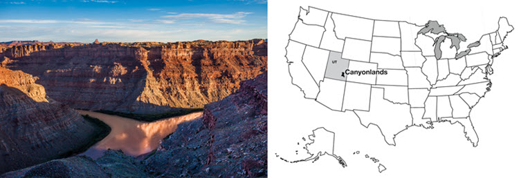
Right: R. B. Alley © Penn State is licensed under CC BY-NC-SA 4.0
Southwest of Moab, Utah lies Canyonlands National Park. A “rough” park with few services available, little water (except for the rather muddy rivers), pot-holed roads, and awesome mountain biking, Canyonlands preserves the confluence of the Colorado and the Green Rivers. Many “visitors” to the park never actually enter it, choosing to gaze down on the Colorado from the vantage point at Dead Horse Point State Park. The two rivers of the park are incised a third of a mile (half a kilometer) or more into the red sedimentary rocks of the Colorado Plateau. Those rocks, mostly sandstones (made from sand) and shales (mud rocks, made from pieces smaller than sand), give the distinctive cliff-slope pattern of the canyons—resistant sandstones form cliffs and cap the flat-topped mesas, while softer shales form slopes.
The great Colorado Plateau, flanked by the spreading regions of the Basin and Range to the West, and the Rio Grande Rift to the east, occupies large parts of Utah and Arizona plus some of Colorado and New Mexico, and includes Zion, Bryce, Capitol Reef, Arches, Grand Canyon, Petrified Forest and Mesa Verde National Parks as well as Canyonlands, and many national monuments and other public treasures. The Colorado Plateau is noted for reddish, flat-lying, rocks from the Paleozoic of a few hundred million years ago.
Take a tour of Canyonlands National Park
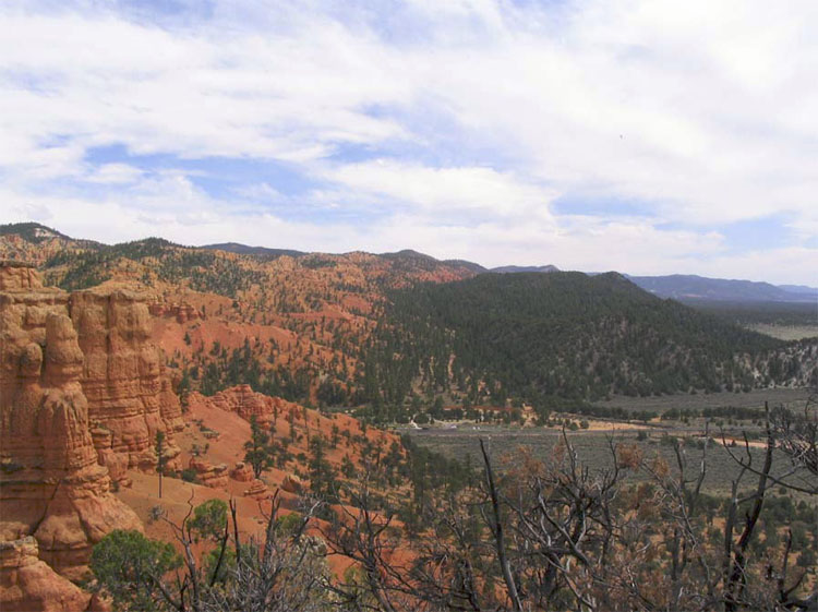
The details are not fully known of how the Colorado Plateau avoided extreme deformation for hundreds of millions of years, while the rocks in most of the West were being bent, broken, or pierced by volcanic eruptions. The silica-rich continental rocks of the Plateau may be a bit thicker than in its surroundings, so the spreading of Death Valley was unable to tear the Plateau apart and instead jumped across to the east side of the Plateau to continue as the Rio Grande Rift (the valley in which the Rio Grande flows). The spreading even seems to have nibbled away at the Plateau, with a few big pull-apart, Death-Valley-type faults visible in places such as Red Canyon just west of Bryce (see the picture below). However, our concern here is slightly different— the role of rivers.

Want to see more?
Here some more information you might also want to explore! (No, it won't be on the quiz!)
Canyonlands National Park
(Provided by USGS)