Motivate...

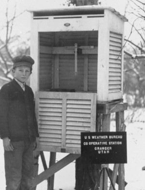
As we start our journey of learning about weather forecasting, we'll start with weather observations. In short, we wouldn't be able to make reasonably accurate weather forecasts without them! Like many scientists, meteorologists rely on observations, and our "science lab" is the atmosphere! In the United States, meteorologists have armies of technical assistants that regularly collect observations, including thousands of "cooperative observers" that volunteer to observe daily precipitation and maximum and minimum temperatures in their hometowns. Thousands more collect daily precipitation data as part of the Community Collaborative Rain, Hail, and Snow (CoCoRAHS) network, for example.
These ordinary citizens (many of whom are weather enthusiasts) provide crucial data that supplement the National Weather Service's primary network of observations (taken at approximately 1,500 airports across the nation). At these "primary" airports, however, trained government observers or automated weather instruments are responsible for collecting routine weather observations. The set of routinely collected measurements includes temperature, moisture, air pressure, wind direction, wind speed, cloud cover, visibility, precipitation and several other atmospheric variables.
These observations form our understanding of how the atmosphere is "behaving" at any given moment and form the basis of weather forecasts. In this lesson, you will learn about some key weather variables and why forecasters are interested in them, as well as learn about how all of these observations can be easily displayed on weather maps. By gaining insight about the atmosphere's present state, you will take the first step toward fashioning your own weather forecasts, or at the very least, having more context for the weather forecasts you may see on television, on the web, or via your favorite mobile weather app.
Lesson Objectives
After completing this lesson, you should be able to:
- Explain when the standard hourly observations are collected and for what hour a particular observation qualifies based on its time stamp. (2)
- Convert times displayed on weather maps in GMT/UTC to a station's local time (and conversely, be able to convert a station's local time to GMT/UTC using appropriate nomenclature).(1)
- Identify the temperature variable (with proper units) from a station model and convert the observation to other units.(1)
- Identify, decode, and interpret the visibility observation on a station model (if displayed).(1)
- Explain when an "obstruction to visibility" symbol (that is, present weather) must be listed on a station model, and identify and decode the "present weather" symbol (if shown).(1)
- Identify and explain the dew point temperature variable (with proper units) from a station model.(1)
- Interpret a station model's sky coverage symbol, giving the official cloud coverage classification and fractional equivalent.(1)
- Identify and decode the sea-level pressure variable from a station model.(1)
- Express the wind direction and speed (including the units) for a given station model "flag."(1)
(Numbers denote mapping to course objectives)