Course Overview
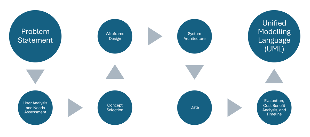
In this course, you will focus on developing a GIS system and designing a project proposal, as well as, investigating some existing and new technologies. The nature of this course allows you to explore a project of your own interest such as a work project, personal interest, hobby, etc. You will develop your term project throughout the semester following published design methodologies that will culminate in a final proposal consisting of 8 stages (Figure 1, below). The course will culminate in a peer reviewed presentation and final paper.

Course Objectives:
Upon successful completion of the course, students will be able to:
- Design a GISystem that solves a spatial problem using the main stages of GIS Design
- Write a proposal describing a GISystem Design
- Justify the development, implementation, and evaluation of the GIS design
- Complete and discuss a variety of geospatial technology lessons
- Apply and discuss the different stages of GIS design.
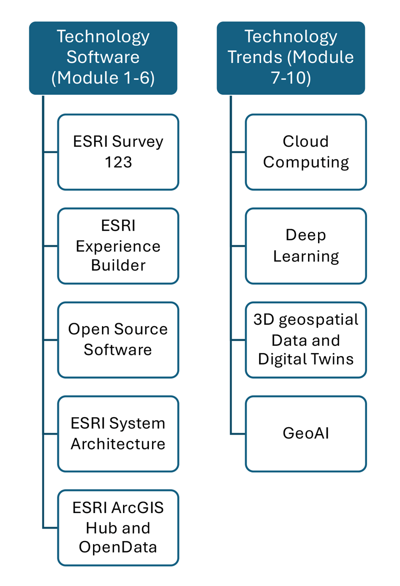
Throughout the semester you will be exploring some existing and new technologies, including proprietary (ESRI) technology as well as open-source technology and data sources. The technology covered in the first 5 modules of the course will include WebGIS proprietary and open-source software, architecture, and data. Then, the last 5 technologies will focus on new technology trends including cloud computing, deep learning, 3D mapping, and GeoAI.
