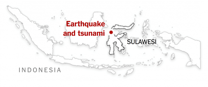
This week, we will learn about how geospatial approaches and technologies were used to respond and recover from the 9.28.2018 Sulawesi Earthquake and Tsunami in Indonesia. This disaster required a large-scale response from many entities including response organizations around the world. The geography of the affected area made it very difficult to reach victims and assess the damage - posing a variety of challenges to geospatial analysts that we will explore this week.
What You Will Learn
By the successful completion of this lesson, you should be able to:
- identify and critique the ways in which GIS was used to respond and recover from the 9.28.18 Sulawesi, Indonesia Earthquake and Tsunami;
- explain the complexity associated with very large disasters that international cooperation;
- revise the final draft of your term project;
- describe and discuss the Internet of Things (IoT) in emergency management situations.
What You Will Do
Lesson 9 is one week in length. To finish this lesson, you must complete the activities listed below.
| To Read |
|
|---|---|
| To Do |
|
Please refer to the Course Calendar for specific due dates.
Questions?
If you have questions about the content or lesson activities, please post them to the General Questions and Discussion forum in Canvas. While you are there, feel free to post your own responses if you, too, are able to help a classmate. If your question is of a personal nature, please email me directly through Canvas.