Reading Sedimentary Rocks
We learn about the past through sediment. Archaeologists dig up past people's garbage dumps and houses to learn how they lived. Historians root through the intellectual sediment of people to learn what they have done. Sedimentary rocks, in the same way, tell the history of the surface of the Earth.
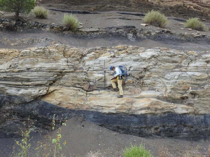
A typical sedimentary rock contains all sorts of clues as to how it came to be. The clast size or grain size is a measure of the energy of transport—tiny clay particles will not settle out of a swift mountain stream, so a fine-grained deposit indicates slow or no currents. Grain shape tells more—an angular clast has not been transported far in water or wind, because during transport sharp corners are knocked off and the clast becomes rounded. Sorting also tells something—wind and water sort sediments by size, but landslides and glacier ice do not, so the sand grains on a beach are all approximately the same size, but a landslide leaves a deposit that ranges from minuscule clay-sized particles up to house-sized boulders and, sadly, pieces of real houses.
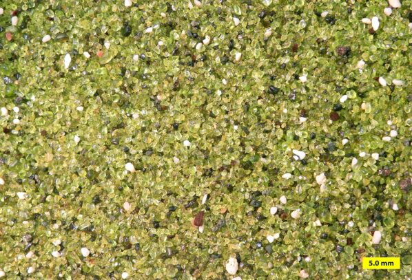
Composition provides clues—olivine is a mineral that is changed rapidly by chemical weathering and occurs primarily in low-silica igneous rocks such as sea-floor basalts, so if you find olivine grains in a sandstone, you know both that the sand was derived from such rocks, and that the sand was not transported very far in a wet environment because the olivine was not broken down. Even surface textures have information—the striations and polish of a glacier-transported rock look very different from the sand-blasted appearance of a quartz grain in a sand dune.

The sizes and shapes of deposits give further information. There are several ways to tell which way a current of wind or water was moving when it deposited a particular rock. For example, with sand dunes, the wind carries sand up a gradual slope and then dumps the sand over the top where it avalanches down and forms a steeper slope. When we find the gentle and steeper slope in the rock, we can tell which way the wind was blowing. Sand ripples and bars deposited by flowing water have similar indicators. A sand body deposited by a stream is often long and skinny in the direction the stream was flowing. A “fossil” sandy beach may be long and skinny like a stream deposit, but the current directions caused by waves will be pointing more-or-less across a beach but along a stream, so there is not much danger of confusing one type of deposit for another.
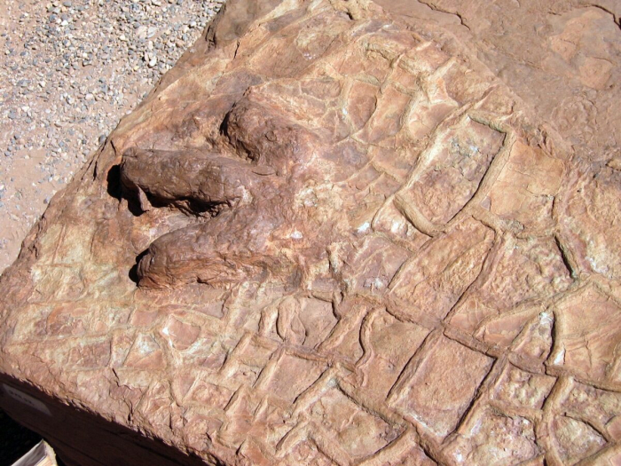
The list of indicators is very long. When mud dries out, it cracks to form mud cracks, as discussed in the Geomation and shown in the picture below. Such features are easily recognized in rocks and indicate occasional drying. Raindrops that spatter down on rocks leave little pock marks that are readily recognized if they are turned to stone and preserved.
Video: Mud Cracks - Capitol Reef National Park (2:20 minutes)
Rocks occasionally are turned upside-down, but nature tells us when that happens. Mud cracks can show us that; they are wide at the top, narrow, and then end at the bottom. Fill mud cracks with another layer of sand or mud, and the cracks are "fossilized," to tell us which way was up when the rocks were deposited. Here, visit Capitol Reef with Dr. Anandakrishnan to see mud cracks, with a brief look at some right-side-up ones from the Grand Canyon.

Added to this, we have the advantage of fossils. Tree trunks in growth position indicate a non-desert deposit on land—trees are replaced by cactus in desert environments, and by seaweed underwater. Coral skeletons indicate a reef in the ocean. Oysters grow in the ocean, as discussed in the Geomation just below.
Video: Oysters! - Capitol Reef National Park (2:01 minutes)
Rocks reveal how and where they were formed. Clues to the history of rock come from how it is put together, whether the pieces are big or little, sorted or mixed, angular or rounded, and so much more. Fossils also provide clues. Here, Dr. Alley and the CAUSE class are out in the desert at Capitol Reef National Park, but they are also in a shallow seaway from long ago. See why.
With such a wealth of information, we certainly should be able to read much of the story of the past. All that is required is that: 1) we study the rocks carefully; 2) we know what sorts of sediments are produced in what sorts of environments today; and 3) we make the common-sense assumption of “uniformitarianism”, that the present is the key to the past.
Suppose you go out today and observe that streams flow downhill and carry rock and mud from the hills to the sea. You dig around in a lot of different streams and find that they have sorted sedimentary beds, occasional fish fossils, and current-direction indicators pointing more-or-less the same way in many different sand bars, with sand bars of certain shapes and sizes and other characteristics that you can measure in many streams. You talk to people, read history books, and learn that streams have been flowing downhill and carrying rock and mud from the hills to the sea for a long time. You find a place where earlier people had diverted a stream into a canal, and you dig up the old stream bed and find that it looks just like modern stream beds. You find still older deposits that look exactly like modern stream beds, and you find deposits in which the sand has been cemented by hard-water deposits to make sandstone, but everything else looks just like modern stream beds.

The reasonable person would say that these “fossil” cemented-to-stone stream beds are indeed old stream beds. Of course, we cannot prove that they are. Perhaps space aliens made the world the year before you were born in such a way that it looks like there were old streams, and the aliens invented all the history books and fake memories of old people. Calvin (of the Calvin and Hobbes comic strip) once told Susie that their class was having a substitute teacher because “our REAL teacher rocketed back to Saturn to report to her superiors. They’re trying to subvert us, little kids, with subliminal messages in our textbooks, telling us to turn in our parents when the Saturnians attack. Earth will be rendered helpless! I’m too smart for ‘em, though! I don’t read my assignments!” (To which Susie replied, “I think one of us has been eating too much paste in art class.”) Maybe Calvin is right. And maybe the Geology-of-National-Parks professors are Saturnian aliens, too! The textbook author, Dr. Alley, has really strange-looking hair where it hasn’t fallen out, and acts a bit peculiarly, you know.
However, despite his occasional interest in the topic, Calvin had not quite mastered geologic thought. Geologists take the common-sense approach: if it looks like a duck, walks like a duck, and quacks like a duck, is genetically identical to type specimens of ducks, has a bone structure as observed in x-ray examination that matches known duck bone structure, mates with other ducks and produces duck offspring, etc., we call it a duck. If it looks like a stream deposit in size, shape, arrangement, location, grain size, sedimentary structures, fossils, etc., we call it a stream deposit. We learn from the present—what streams do, what they make, where they occur—and then we use that knowledge as the key to interpreting the past.
Learning accurately from the present is not easy. By working hard in one or two advanced courses, an adept student can learn to distinguish most of the main deposits—streams versus lakes versus beaches, for example. Many geologists spend their whole lives learning what stream deposits look like, how they form, etc., while others spend their lives working on beaches, lakes, or glaciers.
When lots of these experts agree that the limestones of Bryce and its surroundings were deposited in a shallow lake and adjacent streams and mud flats, you should know that the rock type (limestone, but with differences in chemistry and texture from limestones forming in oceans), the fossils (algae, fish fossils, alligator bones, bird tracks), the structures (mud cracks, raindrop imprints), etc., have been considered carefully in telling the story. We can’t rule out Calvin’s Saturnians, but a more down-to-earth explanation is more convincing.