8.5.3: Welcome to the Operation
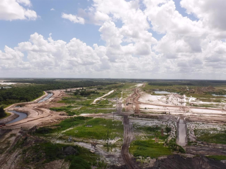
This picture was taken by a Penn State mining engineering intern while riding in the company helicopter!

Figure 8.5.3: Aerial view of Mosaic's phosphate operation
Credit: K. Hutton, © Penn State University, is licensed under CC BY-NC-SA 4.0
The features in this photo will become known to you as we continue.
Best Management Practices (BMP) features and land development
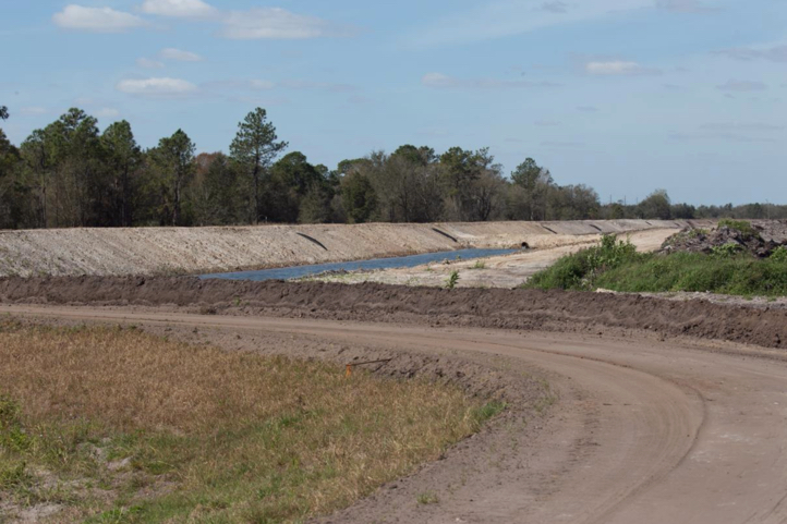
Off to the left side of the photo, you see a waterway that looks like a nicely manicured stream or small river. It is man made, and it is done to control the water table around the mine and ensure that the water table outside of the mine’s perimeter is not lowered or otherwise harmed. At these mines, this “ditch” is known as a best management practice ditch, because it is part of their stormwater pollution prevention plan (SWPPP) required under the Clean Water Act, and is considered a “best practice” to accomplish the intended goal.

Figure 8.5.4: The perimeter ditch
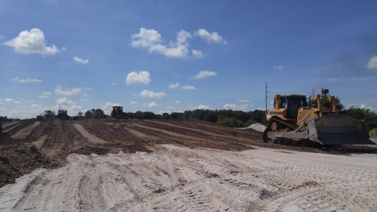
The construction of the BMPs precedes other development activities. Once completed, roadways are constructed into the site, vegetation is cleared, and the topsoil layers are carefully placed away from the active site for use during reclamation. Then, the site will be graded and leveled to provide a working surface for the draglines.
The construction of the BMPs precedes other development activities. Once completed, roadways are constructed into the site, vegetation is cleared, and the topsoil layers are carefully placed away from the active site for use during reclamation. Then, the site will be graded and leveled to provide a working surface for the draglines.
Source: J. Kohler, © Penn State University, is licensed under CC BY-NC-SA 4.0

Figure 8.5.5: Land development
Credit: K. Hutton, © Penn State University, is licensed under CC BY-NC-SA 4.0